Liveable & Healthy Communities
One of the great benefits of the Wasatch Choice Vision is its focus on maintaining our high quality of life. “Livable and Healthy Communities” is actually the first goal of Wasatch Choice. The Vision promotes livable and healthy communities by making healthy choices easier to make – for example through improved access to parks and trails.
Planning Today for Healthy Communities for All
An important way the Wasatch Choice Vision seeks to make livable and healthy communities accessible to all is by enhancing the town centers and downtowns throughout our region. These “centers” are the walkable hearts of our communities in which a variety of transportation choices are available. By locating the heart of our communities where transportation access is greatest – for example near transit stations, freeway interchanges, and trails – more people in our communities can get to many more destinations easily.
As our communities make choices to incorporate open space, parks and pathways, and infrastructure for active transportation, they use the Wasatch Choice Vision and its recreation framework. Click here to discover projects planned in your community.
The Built Environment and our Health
Thoughtfully-built environments support positive health outcomes by making healthy choices easy. Communities can be designed to encourage people to walk, cycle, play in the park, use public transportation, and interact with community members all of which contribute to lifelong health and wellbeing.
What community characteristics have been shown to result in healthier outcomes for residents? Features include:
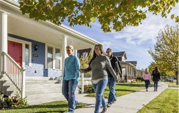
Plan connected, walkable neighborhoods: Small blocks with pedestrian-friendly streets promotes a variety of health benefits while promoting social cohesion, being good for the environment, increasing safety, and enhancing a sense of place. Read more about ten social benefits to walkable places from the Congress of New Urbanism.
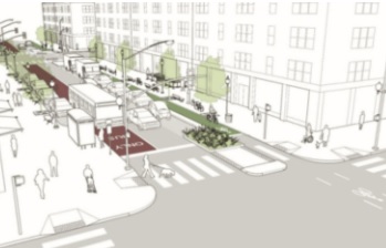
Design streets around safety: When streets are designed with the consideration of safety for all users, people feel more comfortable walking, biking, and taking transit to their destination. Elements such as lighting, street width, traffic calming measures, and protection of vulnerable users are important considerations. A great resource to help design safe, more inclusive streets is the National Association of City Transportation Officials’ (NACTO) Urban Street Design Guide.
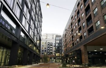
Target development intensity: Strategically selecting specific areas to increase the residents and jobs to land area ratio helps communities and regions plan to accommodate a growing population to a finite amount of space. Higher density does not have to mean high-rise either. A variety of building types can lead to a wider array of housing choices for new residents and positions them in closer proximity to walk to shops, work, entertainment, and public transportation.
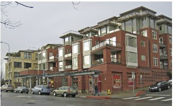
Mix commercial and residential uses: Mixed-use development incorporates different zoning types like residential, commercial, cultural, and others into one space (e.g., a single building, a block, or neighborhood). For example, a development may have commercial on the street-level, office space on the next two floors, and residential on the upper floors. According to the Federal Reserve Bank of Minneapolis, mixed-use development is an integral part of most communities, creating unique places where people can live, work, play and meet everyday shopping and lifestyle needs within a single neighborhood. Learn more via the University of Delaware’s Complete Communities Toolbox.
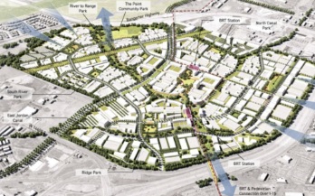
Locate development near transit: Transit-oriented developments maximize proximity of residential, business, and leisure spaces near public transportation. These developments have the ability of reducing car usage, increasing public transportation, and promoting centered urban growth. They typically include a train station, or light rail or bus stop, with a high-density mixed-use area surrounding them. The Institute for Transportation & Development Policy and the Transit Oriented Development Institute both are great resources for further learning.
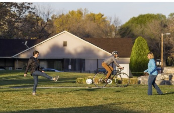
Proximity to parks: It’s important to connect residents with sizeable amounts of open space and recreation within walking distance to where they live. According to the National Recreation and Parks Association, people living a kilometer or further away from a green space have nearly 50 percent higher odds of experiencing stress than those living less than 300 meters from a green space. Parks can provide a fun, safe space for people of all ages to enjoy the outdoors, while providing environmental benefits as well.
Leveraging Infrastructure and Community Resources for a Healthier Tomorrow
Smart management of infrastructure and community resources means thinking about how to best utilize them for the benefit of a broader good, and the health of residents. This may be the very thing they are being used for; however, there may be a higher use determined through engagement of key stakeholders and the broader community.
Good examples of infrastructure and community resources being used to equitably improve the livability and health of our communities include:
- Pairing utility line corridors with trails and pathways
- Adding value to unused public alleys, such as with community gardens or public art installations
- Opening school yards and playgrounds to communities after-hours to function as park spaces
The Transportation and Land Use Connection Program (TLC) reinforces this through its goal to “Create communities with opportunities to live, work, and play.” The well-being of people can be enhanced through community development by broadening the array of affordable transportation, employment, entertainment, recreation, and housing choices. This approach to shaping the built environment results in less pollution, well-connected neighborhoods, more active transportation options, and more opportunities for daily exercise.
Regional applications may include the drafting guidelines for healthy communities through the built environment. Local examples of projects include:
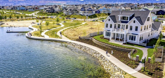
Daybreak Master-Planned Community
Daybreak is a master-planned community over 4,000 acres that began construction in 2004. The community features a community center, with a gym and exercise area, as well as two swimming pools, and a community garden. Along with the 22 miles of trails and over a dozen community parks, there is a man-made lake, Oquirrh Lake. Thanks to ample trail network, walking and bicycling in Daybreak is high, and schools have good connections that enable students to safely get to and from.
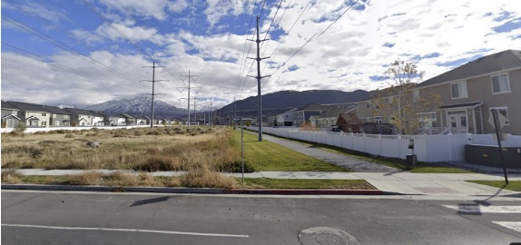
Bluffdale's Utility Corridor & Canal Used as a Path
Along the Wasatch Front, several communities have creatively used infrastructure and community resources to support our region’s collective vision, Wasatch Choice, and its goals of livable and healthy communities; ample parks, open spaces, and recreational opportunities; and quality transportation choices. Bluffdale’s Independence Trail, built along two types of corridors–a canal and utility lines–is one example.
Popperton Plots Community Garden
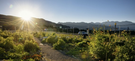
Salt Lake City has recognized the role of fresh food in supporting livable and healthy communities. Back in 2013, the City set aside eight parcels, totalling two acres, of city-owned and managed land for community gardens. One of these parcels, in the Avenues neighborhood of Salt Lake City, became Popperton Plots Community Garden. This one-third acre allotment garden holds about forty plots, four of which are raised-bed and ADA accessible.

Newbridge Elementary School
New Bridge Elementary School in Ogden’s playground is a green, modern safe space for school children, and children from the surrounding neighborhood, to play. The lack of a fence and integration into the neighborhood by sidewalk makes this space a fun and healthy place for children every day of the week. Read more about the neighborhood redevelopment around the school.

